Toronto permit data
How to Check the Zoning of a Toronto Property
Published September 22, 2026
The short version
- The City tells you to use the Zoning By-law Interactive Map to find the zoning on a property. That returns the zone, which is the start of the answer rather than the whole of it.
- The rules themselves live in the by-law text, published as an Office Consolidation in a web version and four PDF volumes. Volume 1 runs to Chapter 800, which is where the by-law defines its own terms, and the 900-series volumes carry the exceptions.
- If your property is shown in grey on the map, the City says it is subject to a Former Municipal Zoning By-law, not to 569-2013. Toronto amalgamated in 1998 and 569-2013 harmonizes many, not all, of the old rules.
- Shading in the by-law text marks provisions that are not in full force and effect. Bright and dark yellow mark provisions under appeal to the Ontario Land Tribunal; blue marks later amendments the City describes only as not in full force and effect.
- The City states that the map and the consolidation are provided for convenience only, that they may not reflect every amendment, and that for legal and planning application purposes the certified documents on file with the City Clerk govern.
How do you find the zoning for a property in Toronto?
Short answer: Search the address on the Zoning By-law Interactive Map, which is the tool the City names for finding the zoning on a property, then read the by-law text behind the zone. Toronto publishes city-wide Zoning By-law 569-2013, its map and its text at the City's zoning by-law page, and directs people who want general zoning information in person to a Toronto Building Customer Experience counter. The zone the map returns is where the answer starts, not where it finishes.
Zoning decides what may exist on a lot, and homeowners meet it late, usually after a design already exists. The tool is public and free. The trap is that it looks finished after the first click.
What does zoning actually control?
Not safety. Zoning is about what may exist on a piece of land and what shape it may take, which is a different question from whether the thing is built properly.
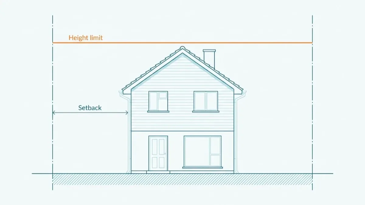
The City's own summary of the by-law is that it "sets the detailed rules for: how land can be used; what can be built; and how buildings must be designed and located". In practice that means the use, and then the envelope: how tall, how far back from each lot line (the setback), and how much of the lot the building may cover.
This is why zoning bites on projects that seem structurally trivial. A garden suite is mostly a zoning conversation, as garden suite and ADU permits in Toronto shows. And the difference between the two reviews is set out in building permit versus zoning approval.
Where do the actual rules live once you have the zone?
In the by-law text, which is a separate document from the map. The City's instruction on its zoning page is to use the Interactive Map to find the zoning on a property, then "view links for by-law chapters, sections and exceptions (if applicable) in the text of the Office Consolidation Zoning By-law 569-2013, as amended".
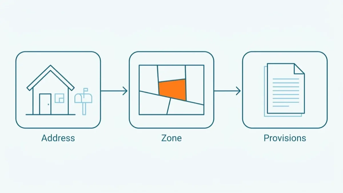
That text is published two ways, as a web version and as four PDF volumes. The volume titles tell you how the by-law is organized, which is the part nobody explains.
- Volume 1 is Chapters 1 to 800. The general and zone-by-zone regulations sit here, and Chapter 800 is the definitions chapter. That matters more than it sounds, because a word like storey means what the by-law says it means rather than what it means in conversation.
- Volumes 2 and 3 are the 900-series chapters, 900.1 to 900.8 and 900.10 to 900.50. This is where site-specific exceptions live, and an exception attached to your lot can change the answer the zone appeared to give.
- Volume 4 is Chapters 970 to 995.
The City's zoning page sets out the sequence as four steps: find your property and zoning category on the map; review what is permitted in your zone, meaning uses and performance standards such as height, setbacks and lot coverage; check for site-specific exceptions in Chapter 900; and review the city-wide and use-specific regulations, which cover things like parking and landscaping across zones. Stopping at the first step is how people get a confident wrong answer.
Quotable: The zoning map tells you which zone you are in. It does not tell you the rules. Those are in the by-law text, and the exception that overrides them is in a different volume again.
What does the colour coding mean?
Two different colour systems are in play, on two different documents, and conflating them is easy.
Grey, on the map, means a different by-law entirely. The City's zoning page states that if your property is shown in grey, it is subject to a Former Municipal Zoning By-law, and gives 416-397-5330 for questions about that case. Toronto amalgamated in 1998, and the City says 569-2013 harmonizes many of the old municipalities' regulations. Many is not all. The Former Municipal Zoning By-laws page lists where each old by-law can be read. If your property is grey, reading 569-2013 carefully will give you a confident, wrong answer.
Shading in the by-law text means a provision is not in full force and effect. The City sets out three cases on its zoning page. Portions shaded bright yellow were originally enacted on May 9, 2013 and are under appeal to the Ontario Land Tribunal, the provincial body that hears planning appeals, and its predecessors. Portions shaded dark yellow are later amendments that are also under appeal. Portions shaded blue are later amendments that the City describes only as not in full force and effect, without the appeal wording. In all three cases the practical meaning is the same: you are reading text that is not currently operative.
Everything carries a disclaimer. The City states that the Interactive Map and the Office Consolidation are provided for convenience purposes only, that they may not reflect all amendments passed by Council or approved by the Ontario Land Tribunal, and that for legal and planning application purposes reference should be made to the original certified documents on file with the City Clerk. The same page lists city-wide amendments that are in force but not in the July 31, 2024 consolidation, among them the multiplex, sixplex and low-rise residential lands by-laws. Read that list before relying on the text.
When is the map not enough?
When money depends on the answer. The map is excellent for ruling things out early and for understanding the shape of a problem. It is not the instrument for confirming that a specific design complies.
At that point use the City's own routes. General Zoning By-law information is what Toronto Building's appointments are for, and for development applications rather than general information, its contact page lists named planning consultants by district. The zoning page also gives 416-397-5330 and bldinquiries@toronto.ca for help interpreting the by-law.
How does zoning connect to the permit record?
The permit record will not tell you a property's zoning, but it does show what has been permitted there before.
Search the Toronto permit record by address and look at what was built and permitted on the property and on its neighbours. A row of comparable projects is not a guarantee, because an exception can apply to one lot and not the one next door, but it is a useful sanity check on whether an idea is unusual for the street. Our guide to the permit history of a house covers reading that record properly, and what requires a building permit in Ontario covers the other half of the review.
Methodology and limits
Everything described above comes from the City of Toronto's own pages, each linked in the sentence that uses it and read on September 17, 2026 and again on September 22, 2026: the zoning page for the map, the four steps, the by-law volumes, the shading rules, grey properties and the disclaimers; the Former Municipal Zoning By-laws page for where the old by-laws are published; and Toronto Building's contact page for the planning consultants. This page carries no permit statistics by design, and it quotes no zoning number, because the numbers that matter are property-specific and live in the by-law text rather than on a guide.
Three limits apply. This is Toronto, and every Ontario municipality publishes its own by-law its own way, so none of the structure here transfers outside the city. The City states that its map and consolidation are for convenience only and that the certified documents on file with the City Clerk govern, so treat those as authoritative if they differ from anything here. And PermitIndex publishes the permit search this page links to, which is our own product; the permit data behind it is described on the data sources page, which also carries the address to write to if you find something wrong here.
Frequently asked questions
- How do I find out what my property is zoned in Toronto?
- Use the Zoning By-law Interactive Map, which is the tool the City points to for finding the zoning on a property, and search the address. That returns the zone under city-wide Zoning By-law 569-2013. The zone on its own is not the answer, because the rules attached to it live in the by-law text. The City publishes that text as an Office Consolidation, in a web version and in four PDF volumes, and tells you to view the chapters, sections and exceptions that apply to your property there.
- What does it mean if my property is grey on the Toronto zoning map?
- It means city-wide By-law 569-2013 is not the by-law for that property. The City's zoning page states that if your property is shown in grey, it is subject to a Former Municipal Zoning By-law, and it gives 416-397-5330 for questions about that case. Those are the by-laws of the municipalities amalgamated into Toronto in 1998. If your property is grey, the rules you need are in the former by-law for that area, not in the one you were just reading.
- What is Zoning By-law 569-2013?
- It is Toronto's comprehensive, city-wide zoning by-law. The City describes it as zoning regulations that apply to properties across the city, setting the detailed rules for how land can be used, what can be built, and how buildings must be designed and located. Before amalgamation in 1998 each former municipality had its own by-law, and the City says 569-2013 harmonizes many of those regulations. Many, not all: a property shown in grey on the map is still governed by a former municipal by-law.
- Does the zoning map count as legal confirmation of the rules?
- No, and the City says so on the page. It states that the Interactive Map and the Office Consolidation are provided for convenience purposes only, and that for legal and planning application purposes reference should be made to the original certified documents on file with the City Clerk. It separately warns that both the map and the by-law may not reflect all amendments passed by Council or approved by the Ontario Land Tribunal, the provincial body that hears planning appeals. The map is the right tool before you spend money. It is not the document you rely on when something is at stake.
- Is zoning the same as a building permit?
- No, but in Toronto one is checked inside the other. Zoning asks whether the use and the shape of a building are permitted on that site; the Building Code asks whether it is built safely. The City states that building permit applications are currently being reviewed for compliance with the applicable zoning by-law, so a design that is structurally sound can still be held up on zoning. That is why the zoning question is worth answering first.